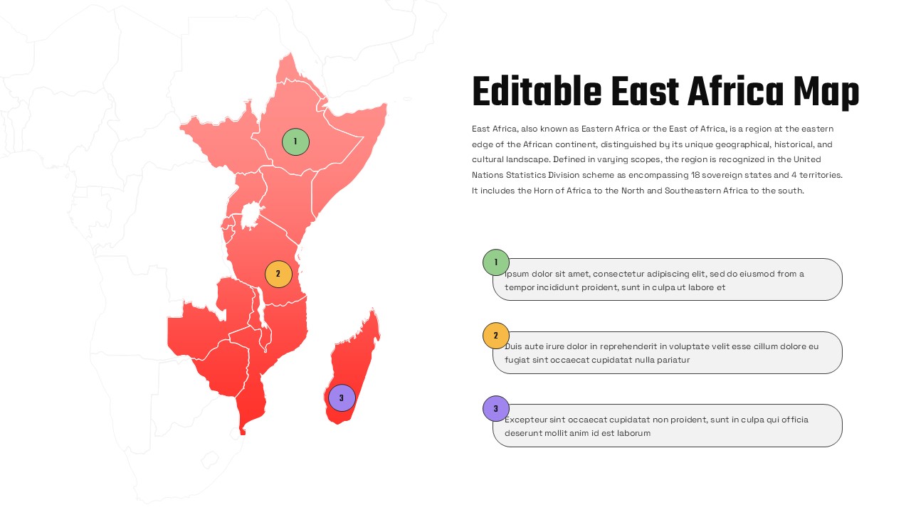
Editable East Africa Political Map Slide Template for PowerPoint & Google Slides

East Africa map slide with red highlighted countries, three numbered markers, and right-aligned description boxes.

This template is part of a deck featuring multiple slides. To check out all slides.

See All

Product Description

Customizable East Africa Political Map Presentation Template

Present geographic insights with clarity using this Editable East Africa Map Infographic Template for PowerPoint & Google Slides. This professionally designed slide features a detailed East Africa political map with clearly defined country borders and a vibrant red gradient fill that highlights the region against a subtle greyed-out African continent background. Three numbered circular markers are strategically placed across key areas of East Africa, each connected to rounded text boxes on the right, enabling you to explain locations, markets, projects, or strategic initiatives in a structured format.

The Editable Map of East Africa Infographic Template for PowerPoint & Google Slides is ideal for showcasing regional analysis, market expansion strategies, development programs, logistics networks, or educational overviews. The clean layout balances visual impact and readability, with bold typography for the main heading and neatly aligned content sections for descriptions. Fully customizable shapes, colors, and text placeholders allow you to adapt the to your branding, highlight specific countries, or add additional markers as needed.

Optimized for both PowerPoint and Google Slides, this slide ensures high-resolution clarity across devices and screen sizes. Whether you are delivering a business briefing, academic lecture, NGO report, or regional strategy presentation, this map infographic helps you communicate geographic data with precision and professional appeal.

Features of this East Africa Map template

• Detailed East Africa political map with clearly outlined country borders.
• Three numbered circular markers linked to rounded description boxes.
• Bold title area with supporting paragraph text for regional context.
• Fully editable shapes, colors, fonts, and text placeholders.
• Clean two-column layout for balanced visual hierarchy.

Why use this template

• Visualize regional strategies, expansion plans, or development initiatives effectively.
• Simplify complex geographic information into a clear, structured format.
• Enhance audience engagement with location-based storytelling.
• Save time with a ready-to-edit East Africa map slide for professional presentations.

Who is it for

Business analysts, consultants, NGO teams, educators, government agencies, and corporate strategists presenting regional insights about East Africa. It is also suitable for logistics planners, market researchers, and international development professionals who need to highlight specific countries or territories within East Africa in a clear, visual format.


Login to download this file

What do you think about this template? Give a rating