
5 Oceans Map Presentation Template for PowerPoint & Google Slides
5 Oceans Map Presentation Template
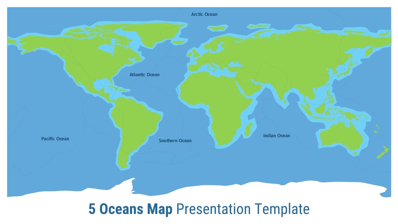
This 5 Oceans Map for PowerPoint & Google Slides provides a comprehensive world map featuring all five major oceans clearly labeled and color-coded. The design utilizes a bright lime green for continental landmasses against ocean blue water bodies, creating excellent visual contrast. The full-width map occupies the majority of the slide space with clean white typography for ocean labels, ensuring maximum readability and professional presentation quality.
This 5 Oceans Map for PowerPoint & Google Slides is ideal for educators teaching geography and oceanography, environmental scientists discussing climate change and marine ecosystems, and business professionals presenting global logistics or maritime operations. The template supports academic lectures, training materials for maritime industries, international shipping presentations, and environmental studies requiring accurate ocean identification and global geographical context for effective knowledge transfer.
The template offers full editability allowing customization of colors, text labels, and design elements to match specific presentation needs. Users can easily modify ocean names, add additional geographical markers, or adjust the color scheme while maintaining professional visual standards. This flexibility ensures seamless integration into existing presentation decks while delivering clear, impactful geographical information.
Features of this 5 Oceans Map Template
• Full-width world map with clear continental and oceanic boundaries
• All five major oceans clearly labeled with professional typography
• High-contrast color scheme with lime green landmasses and ocean blue waters
• Clean, minimalist design optimized for educational and business presentations
• 16:9 aspect ratio compatible with modern presentation standards
Why use this 5 Oceans Map Template
• Provides accurate geographical reference for global ocean identification
• Saves time with pre-designed professional cartographic layout
• Enhances audience understanding through clear visual ocean differentiation
• Supports multiple presentation contexts from education to business applications
Who is it for
This template is perfect for geography teachers, marine biology instructors, environmental scientists, oceanography researchers, maritime industry professionals, logistics coordinators, climate change educators, and business analysts presenting global data requiring oceanic geographical context.
Login to download this file


