

Scandinavian Map PPT Templates


Scandinavian Map Template
The Scandinavian Map Template for PowerPoint and Google Slides is a professionally designed Nordic countries map presentation resource built for geography educators, business analysts, cultural researchers, tourism professionals, and international business strategists who need a clean, accurate, and visually compelling geographical presentation tool for academic lectures, Nordic market analysis, and regional studies.
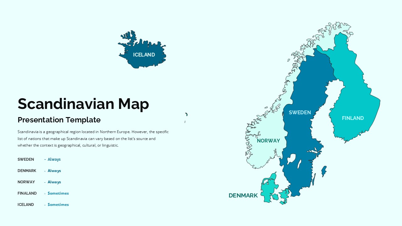
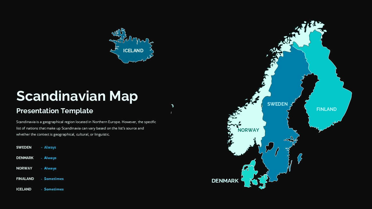
This Scandinavian map template features a detailed color-coded Nordic countries map using carefully calibrated shades of blue and teal that clearly distinguish between countries always included in Scandinavian geographical definitions and countries sometimes included depending on cultural and regional classification contexts. The informative legend system, clean minimalist design aesthetic, and well-balanced split layout combining explanatory geographical text with the detailed Scandinavian countries map creates a visually authoritative presentation resource that communicates complex Nordic regional geography with clarity, accuracy, and professional confidence in every presentation environment.
Both light and dark theme variations ensure this Scandinavian PowerPoint template and Google Slides template adapts seamlessly to different classroom settings, conference room displays, and audience preferences while maintaining excellent visual clarity and professional design quality throughout. Every element is fully customizable including map color coding, country classifications, legend categories, and text content, allowing presenters to highlight specific Nordic countries, modify regional definitions, and add geographical details to match specific presentation objectives.
Compatible with both Microsoft PowerPoint and Google Slides, this Nordic map template works effortlessly across all devices and presentation platforms, making it instantly accessible for classroom instruction, business presentations, academic research, and professional geographical discussions in every environment.
Whether you are teaching European geography, analyzing Scandinavian business markets, presenting Nordic cultural research, or building international tourism presentations, this Scandinavian Map Template delivers the geographical accuracy, visual clarity, and professional design quality that every Nordic region presentation deserves.
Login to download this file


