

Seven Continents Map PPT & Slides Templates

Professional Seven Continents Map Template
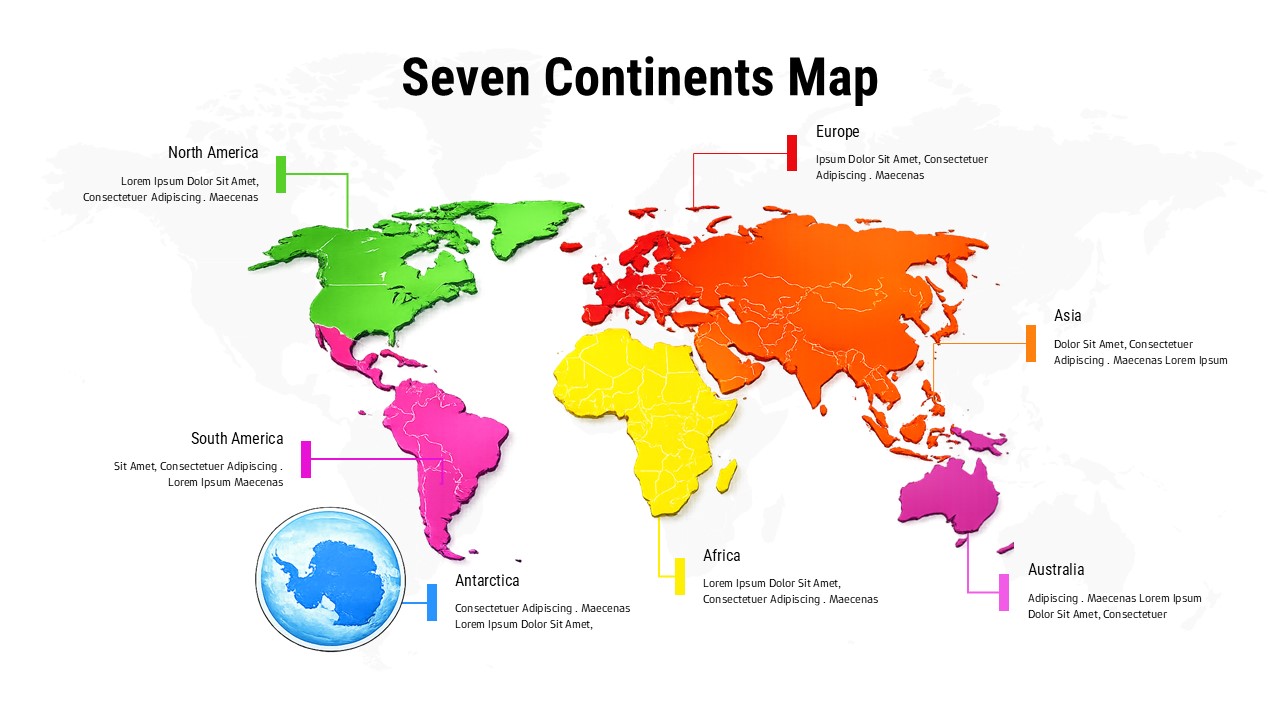
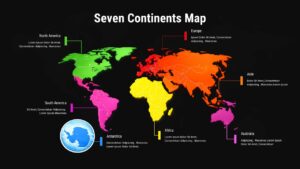
This Seven Continents Map Template for PowerPoint and Google Slides is a versatile geography visualization tool featuring color-coded continents and interactive callout boxes. Designed with a modern flat aesthetic, the template includes clear continental divisions and a unique circular inset specifically for Antarctica, ensuring complete global representation. It is highly customizable, allowing users to adjust colors to match branding, modify callout boxes, and replace placeholder text for targeted messaging. Whether used for academic lectures, international market analysis, or corporate strategy, this professional design enhances audience engagement while significantly reducing presentation preparation time.
Key Features and Benefits
Dual Theme Versatility: Includes both light and dark versions to suit various presentation environments and branding requirements.
Enhanced Visual Clarity: Features high-contrast, color-coded regions and professional typography for optimal readability across all devices.
Strategic Callout Boxes: Equipped with editable text placeholders and connecting lines to highlight specific regional data or insights.
Complete Customization: Full flexibility to modify colors, text, and layout elements to fit specific educational or business contexts.
Diverse Applications: Ideal for educators teaching world studies, business professionals presenting global operations, and marketing teams analyzing international markets.
Professional Accuracy: Includes a dedicated Antarctica circular inset to provide a comprehensive and accurate world map view.
Login to download this file


