

Labelled Middle East Map PowerPoint & Google Slides Templates
Editable Labelled Middle East Map Template
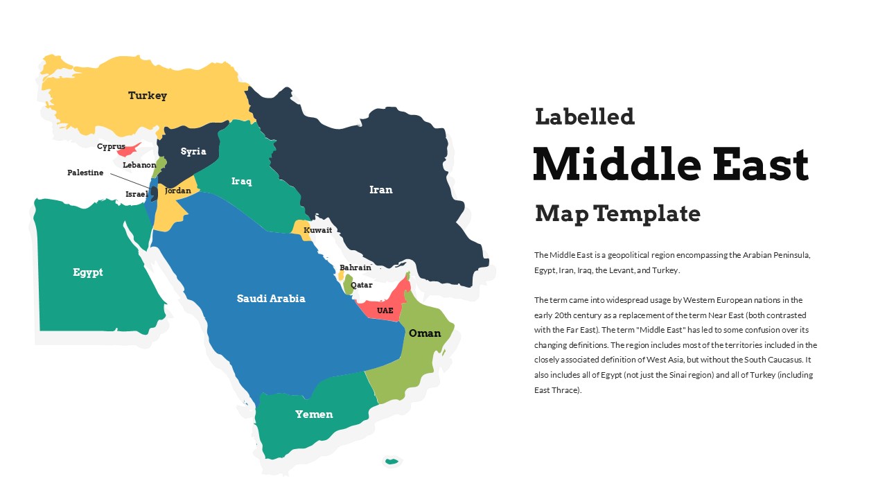
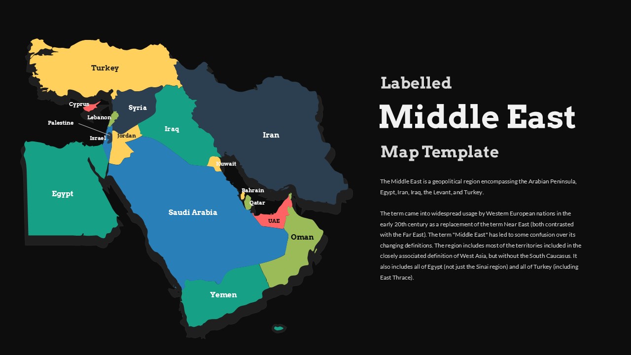
Understanding the Middle East requires more than data it requires geographic context that audiences can see, read, and reference instantly. This Labelled Middle East Map Template for PowerPoint & Google Slides delivers exactly that through a vibrant, color-coded map that covers the entire region with clearly labeled country boundaries, making it an immediately useful visual for any presentation that touches on Middle Eastern geography, politics, economics, or culture.
The template uses a clean split layout that positions the detailed map on the left and provides open content space on the right for text, data, analysis, or commentary. Every major country in the region is distinctly colored and clearly labeled including Turkey, Egypt, Saudi Arabia, Iran, Iraq, Jordan, Syria, Yemen, Oman, UAE, Kuwait, Qatar, Bahrain, Lebanon, Israel, Palestine, and Cyprus giving audiences an accurate and comprehensive picture of the region at a glance. The color differentiation between countries makes it easy to distinguish borders and geographic relationships without requiring any prior knowledge of the region. Both a white and a dark background version are included so the template adapts to different presentation styles and environments without any redesign required.
Features of this Template
- Vibrant color-coded map with all major Middle Eastern countries clearly labeled
- Split layout design with map on the left and open content space on the right
- Includes Turkey, Egypt, Saudi Arabia, Iran, Iraq, Jordan, Syria, Yemen, Oman, UAE, Kuwait, Qatar, Bahrain, Lebanon, Israel, Palestine, and Cyprus
- White and dark background versions included for presentation flexibility
- High-quality 16:9 aspect ratio optimized for modern presentation displays
- Fully editable colors, labels, text, and layout elements throughout
- Compatible with PowerPoint and Google Slides
How to Use This Template
Open the file in PowerPoint or Google Slides and start by choosing between the white or dark background version depending on your presentation context. Add your own text, data points, or analysis to the content area on the right side of the layout. To highlight a specific country or region, select the relevant shape on the map and update its fill color to draw audience attention to that area. Add callout boxes, arrows, or data labels directly onto the map to annotate specific locations or highlight key geographic points relevant to your presentation. All elements are fully editable and require no advanced design skills to customize.
Best Used For
- Geography and political science education and classroom presentations
- Regional market analysis and business expansion strategy sessions
- Government policy briefings and diplomatic presentations
- Geopolitical analysis and international relations discussions
- Journalism and media presentations covering Middle Eastern news
- Academic research presentations on Middle Eastern studies
- Corporate strategic planning for companies operating in the region
- Cultural studies and international business context presentations
Login to download this file


